
One drive, end to end
How it actually works.
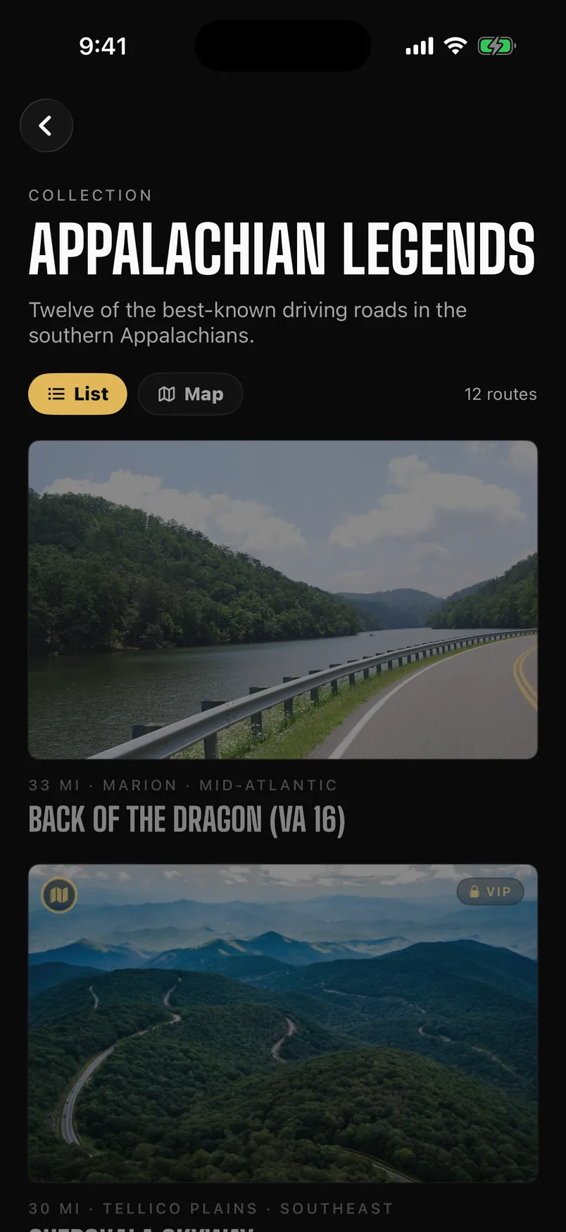
Find it
Roads worth the fuel, not the fastest way there
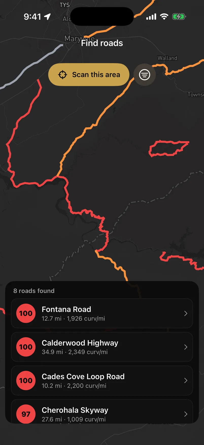
Scan any area and every road in it comes back scored on how much it actually bends — curvature per mile, measured off the road's own geometry. Or start from a collection somebody already drove.
Learn it
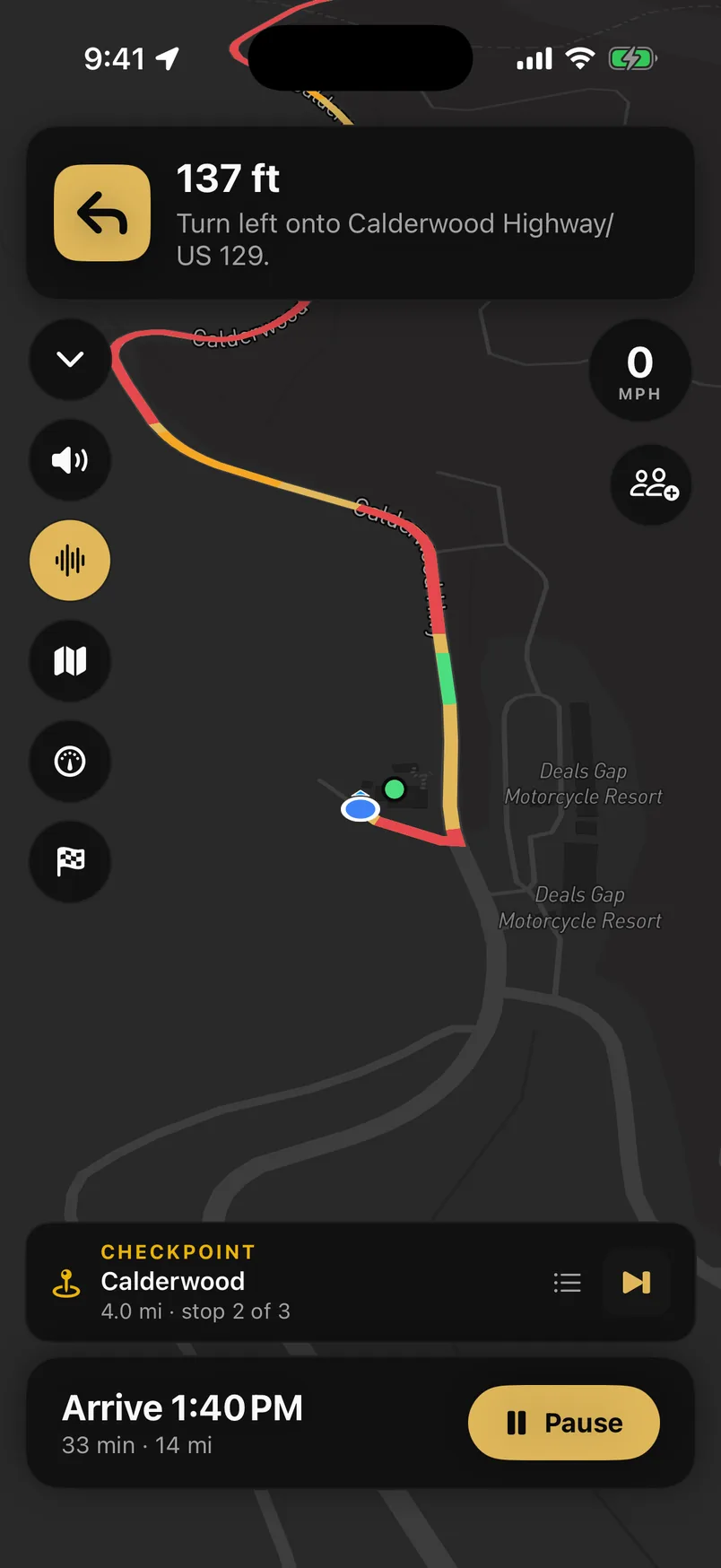
Know the corner before you can see it
Every corner on the route is graded 1–6 from its radius and how far the road turns through it, then called out as you approach — and the line ahead is painted with what's coming.
Drive it
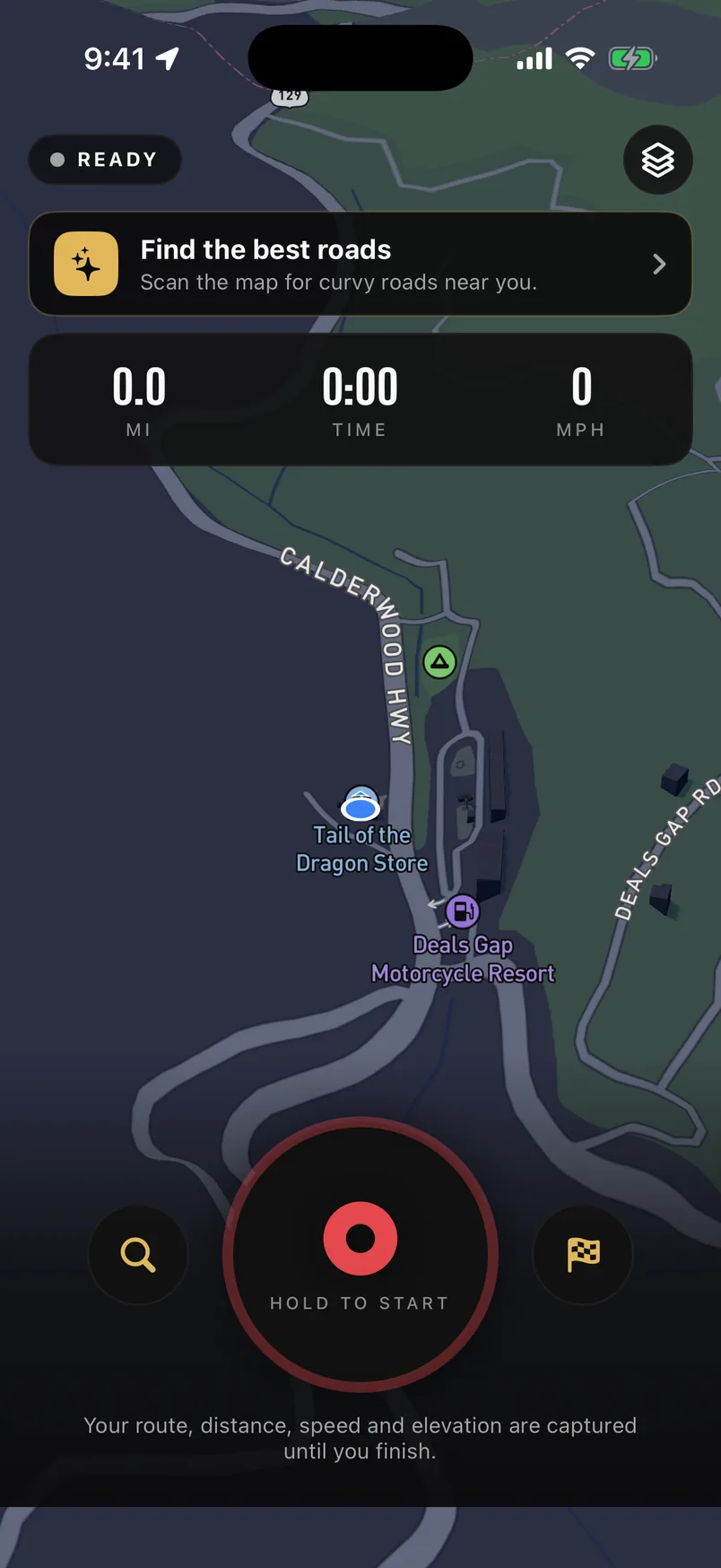
The whole run, measured
Distance, moving time, top and average speed, elevation gained, and peak lateral g read from the phone's motion sensors. Hit record at the bottom of the hill and forget about it.
Settle it
Then watch it back, and compare
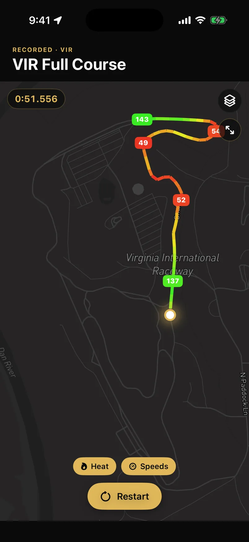
Your drive replays along the road with the line coloured by speed, so the corner you fluffed is obvious. Drop a marker on a bend and everyone who drives past it lands on the same board.
The whole list
Everything else.
Pace notes
Every corner called out before you reach it, rally-style — in plain English or the 1–6 scale. The road ahead is colour-coded by how hard each corner is.
Turn-by-turn navigation
Voice-guided, road-snapped directions through every checkpoint.
Live cruise map
See nearby drivers move in real time and drop into the action.
Drive tracking & replay
Speed, lateral g, elevation and distance on every run — then watch the drive back as a speed-coloured replay.
Read more →
Drag timer
0–60 and 60–130, timed off GPS and interpolated between fixes. Or roll it: hold 60 for three seconds and go.
Read more →
GPX & Google Maps export
Take any route with you — download it as GPX for your Garmin or GoPro, or open it straight in Google Maps.
Read more →
Speed markers
Drop a marker on a road, or set a club trap. Drive past and your speed through it is logged to the board.
Read more →
Clubs & leaderboards
Build a crew with its own feed, routes and speed traps — and rank on distance, top speed, max g and elevation.
Read more →
E85 station finder
Flex-fuel stations plotted on the map from live NREL data, with one tap to navigate.
Read more →
Apple CarPlay
Native nav, route start and convoy view right on the dash.
Live convoy map
Roll deep with live positions, honk and hazard signals, regroup pins, and a recap at the end.
Events & rallies
Host drives with RSVPs, a schedule, an attached route, and who's on their way.
Social feed
Reactions, comments, @mentions, photos, profiles and achievement badges.
Offline maps
Download a route's map for trips with no signal.
Featured guides
Curated must-drive roads with full writeups, specs and maps.
Where it runs
Phone for the drive.
Web for the planning.
Anything that measures a drive needs to be in the car with you, so it lives in the iPhone and Android apps. The web is where you plan a route at a desk, read a featured drive, and share a link with someone who hasn’t installed anything.
In the apps only
iPhone and Android. These need GPS, the phone’s motion sensors, or the screen in front of you while you drive.
- Pace notes
- Turn-by-turn navigation
- Live cruise map
- Drive tracking & replay
- Drag timer
- GPX & Google Maps export
- Speed markers
- E85 station finder
- Apple CarPlay
- Live convoy map
- Offline maps
On the web as well
Open in any browser, no install. The apps do more with each of these — the line is spelled out below rather than left to guess at.
- Clubs & leaderboards
The web has the club page and its feed. The Routes and Markers tabs, and five of the seven boards, are in the apps.
- Events & rallies
Browse, RSVP and host on the web. Turn-by-turn to the meet is in the apps.
- Social feed
Read and post on the web. Push notifications are app-only.
- Featured guides
Every featured drive is readable on the web without an account.
A few things differ between the two apps as features land on one first — the rolling 60–130 start and GPX export are on iPhone today. And some of this is part of VIP, which is where the detail lives rather than scattered across this page.